

The Communities
Bonners Ferry is the hub, and around it Boundary County is a scattering of small places along the river and the highways, each with its own character.
When a buyer tells us they want something remote, we ask what remote means to them. The answers are all over the map. For some it is a quiet street a few minutes from the coffee shop. For others it is 40 acres backed up against national forest at the end of a 5-mile dirt road. Boundary County has room for both, and most of this chapter is about figuring out which one you are.
Boundary County at a glance. Simplified for orientation, not navigation. Contours every 150 m from USGS/SRTM elevation data via Mapzen Terrain Tiles.
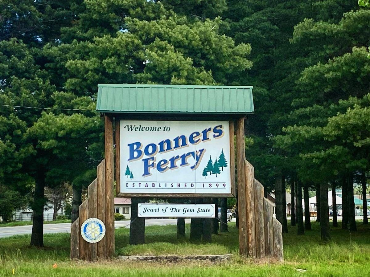
Bonners Ferry
The county seat: brick Main Street, the hospital, schools, shopping and city utilities.
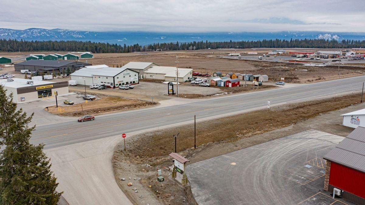
North Bench and Three Mile
Acreage homes on open level ground, the airport, and the county’s growing commercial corridor.
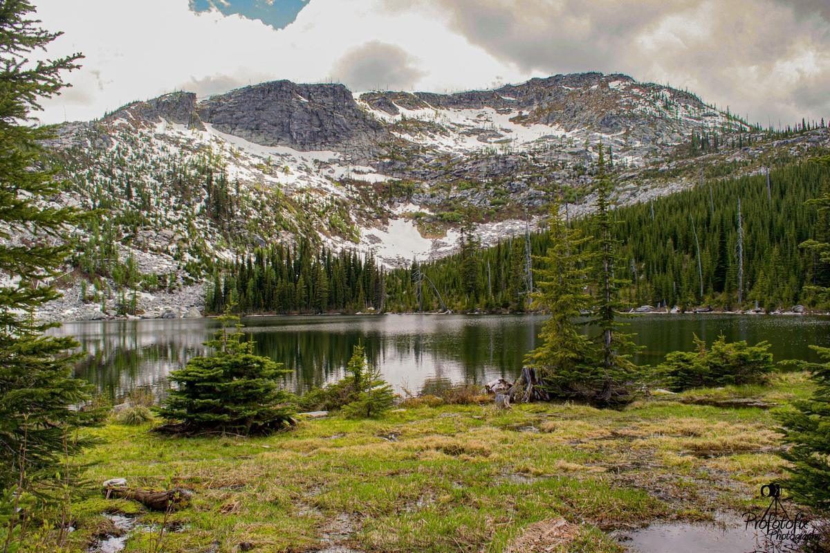
Naples
A small community on Deep Creek known for acreage, hobby farms and its historic general store.
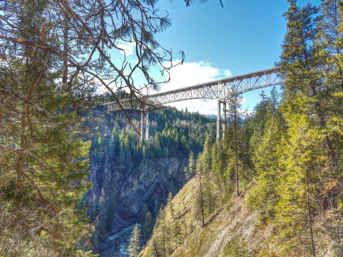
Moyie Springs
A timber town of about 820 where the Moyie meets the Kootenai, anchored by the mill.
Eastport
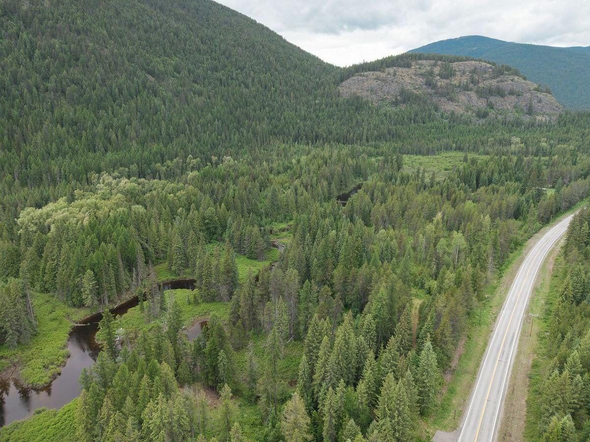
The 24-hour border crossing and the main gateway for Canadian visitors.
Porthill and Copeland
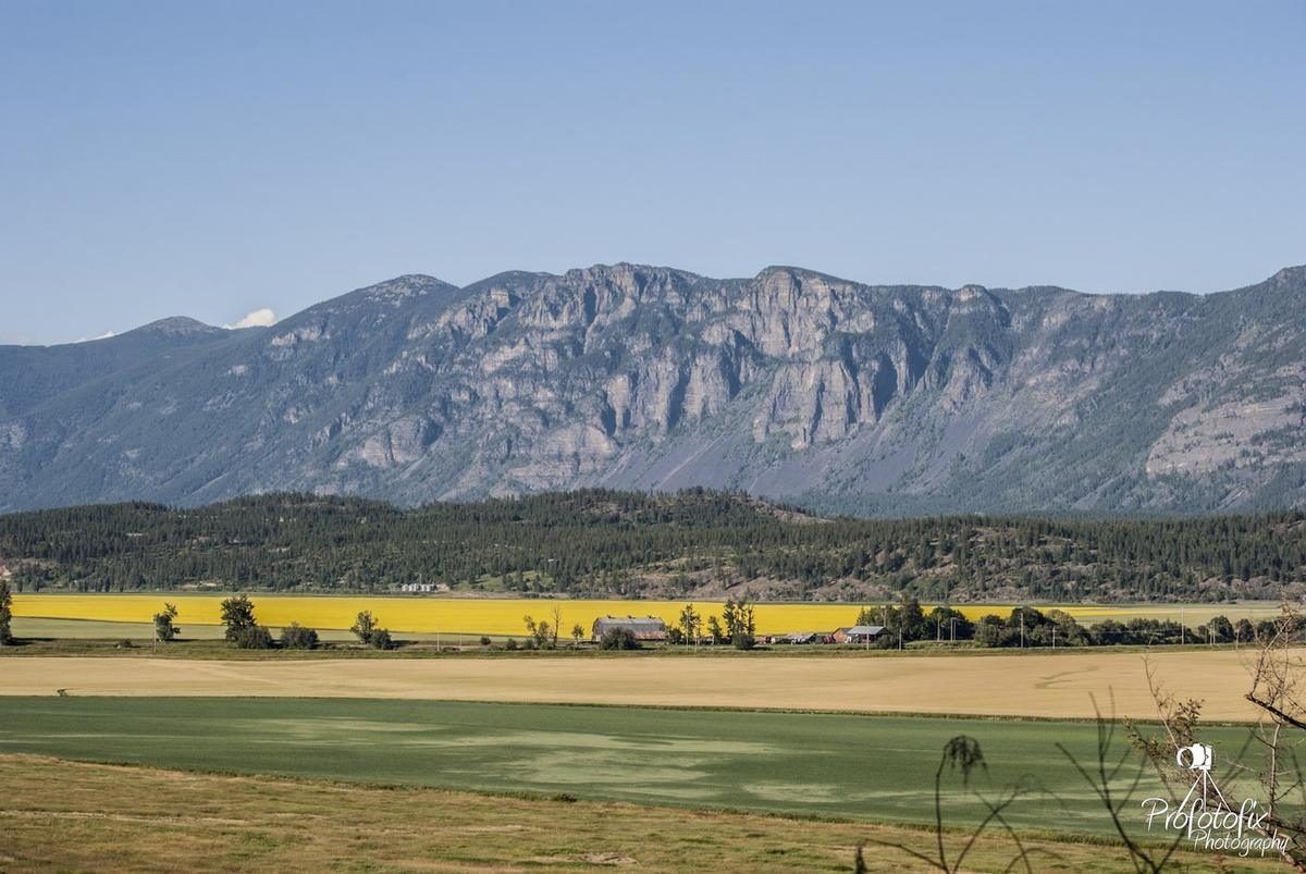
The farm country of the lower valley, from big-parcel farm ground to the Rykerts, B.C. crossing.
Bonners Ferry, Idaho
Bonners Ferry is Boundary County's seat and its everyday center, a city of about 2,520 people (2020 Census) on the Kootenai River, roughly 27 miles south of the Canadian border. Nearly everything the county runs on is here: the hospital and clinics, the schools, the courthouse and city hall, grocery stores, restaurants, and a historic downtown of brick storefronts along Main Street, with the Selkirk Mountains rising right behind town.
The town owes its name to a river crossing. The Kootenai Tribe had lived in the valley for generations, fur trader David Thompson passed through in 1808, and when gold was discovered in British Columbia's East Kootenays in 1863, prospectors streamed north along the Wild Horse Trail. A Walla Walla merchant named Edwin Bonner started a ferry across the Kootenai here in 1864, and Richard Fry and his wife, Justine, later ran it. The steamer Midge began carrying passengers and freight in 1883, the Great Northern Railway arrived in 1892, and the town grew up on the river's south bank through the 1890s; the city marks 1899 as its founding year.
Timber and farming built the local economy. Logging and milling remain major employers today. Out in the valley, landowners diked and drained the Kootenai bottomland into productive farm ground. The river shaped downtown too: spring floods once kept buildings up on stilts, until brick replaced them and the Libby Dam, finished upstream in 1975, tamed the high water.
For buyers, Bonners Ferry offers the widest range of options in the county: in-town homes on city water, sewer, and power with fiber internet available, walkable access to downtown and schools, and quick drives out to acreage in the surrounding valley and foothills.
North Bench and Three Mile
The North Bench is the high ground just north of town, above the Kootenai River. Highway 95 climbs onto it from Bonners Ferry, and about 3 miles out, Highway 2 splits off toward Moyie Springs and Montana. Locals call that intersection Three Mile. Most of the bench is still homes on acreage, open level land with mountain views, and the highway corridor through it has become the county’s growing commercial area.
The corridor has grown into the county’s working and shopping district. Along Highway 95 there is a truck stop with a sit-down cafe, a newer travel center with fuel and fast food, a farm and ranch store, a discount store, and a country store with a bakery, bulk groceries and lunch, plus a 24-hour gym, equipment rental, a shipping depot and self storage. It is where a lot of the county’s vehicles get fixed, with several mechanics, auto body shops and a tire store. The building trades are here as well. Along both highways you will find three building supply yards, a metal roofing and siding supplier, cabinet and countertop shops, a custom lumber mill and a welding shop. The Boundary County Airport, the county’s general aviation field, is on the bench too. Water is through the Three Mile Water District, and fire protection is through the North Bench Fire District.
Naples, Idaho
Naples is a small, unincorporated community on Highway 95, about 10 miles south of Bonners Ferry and 23 miles north of Sandpoint. It sits along Deep Creek, tucked between the mountains and two rail lines, so flat ground is scarce, and that's a big part of its appeal. Homes here tend to be on wooded acreage and small hobby farms rather than in-town lots, which makes Naples a natural fit for buyers who want room for livestock, a garden, or simply some privacy.
The town dates to 1892, when the Great Northern Railway finished its line through the valley. The crew wanted to name the stop "Poppsville" after Louis Popp, but he chose Naples instead, in honor of the Italian workers who built the railroad. Long before the tracks, the old Wild Horse Trail passed through here too, used by tribes, settlers, and gold seekers.
Two institutions sit at the heart of the community. The Naples General Store, in its current building since the Mackey brothers opened it in 1934, is still part general store and part post office, with its original wide plank floors and old-fashioned gas pumps where you still pay inside. Naples Elementary carries on a school tradition that goes back to about 1892: the first wooden schoolhouse burned in 1914, and today's brick building went up in 1932. The Northwoods Tavern & Grill and Blue Lake RV Resort are close by as well.
Families here also have a real choice in education without leaving the area: Naples Elementary is a public K–5 school in the Boundary County School District, and the new Foundations School is a private K–12 school just outside town.
Moyie Springs, Idaho
Moyie Springs sits a few miles east of Bonners Ferry on Highway 2, where the Moyie River joins the Kootenai. From town you can see both the Selkirk and Cabinet ranges, and it's only minutes from the Montana line and about half an hour from the Eastport crossing. Incorporated in 1947 as Boundary County's second city, it's home to about 820 people today (2020 Census).
Timber built this town, and it still runs through it. The largest business in Moyie Springs is the Idaho Forest Group lumber mill on the bluff above the river. Plenty of local families have worked in the woods and at the mill for generations, and that shared history gives the community a close, neighborly feel.
The town's landmark is the Moyie River Canyon Bridge, a steel truss span completed in 1965 that stretches 1,223 feet and stands 464 feet above the water, one of the highest bridges in Idaho. Upriver sits the Moyie Dam. Down at the confluence, Twin Rivers Resort, owned by the Kootenai Tribe, has a boat launch and the tribe’s sturgeon and burbot hatchery; its RV park is closed for renovations. Downtown is small and practical: a post office, a modest city hall with a little park beside it, and the Moyie Store.
New homes have been going up in recent years. For buyers, Moyie Springs offers riverside and wooded properties with a quick drive into Bonners Ferry for work, school, and shopping, plus a small-town community where people still know their neighbors.
Eastport, Idaho
At the very top of Highway 95, where the Moyie River canyon meets the 49th parallel, Eastport is Boundary County's main gateway to Canada. The U.S. Port of Entry here has run around the clock since 1961 and faces Kingsgate, B.C. across the line, with customs brokers and a duty-free shop at the crossing. For travelers from Calgary, Edmonton, and southern British Columbia, it's the front door to North Idaho and the International Selkirk Loop.
Eastport was born with the railroad. In 1906 the Spokane International pushed north to meet the Canadian Pacific here, and the little settlement became a switching point for freight and passengers moving between the two countries. Eastport and Kingsgate grew up as one community of a couple hundred people, sharing a hall, social life, and a one-room school that taught children from both nations until it closed in 1940. Locals made a living on the railroad and in the woods, cutting cedar poles and harvesting ice in winter, and a handful of hotels, cafes, and a general store served the traffic. The U.S. inspection station and customs housing were built in 1936, and long before any of it, the old Wild Horse Trail carried gold-rush traffic through the same canyon.
Today Eastport is small and unincorporated, with its own post office, and it anchors the northern stretch of the county. South along Highway 95, the open meadows of Round Prairie hold some of the area's ranch and pasture land, framed by timbered mountainsides. For buyers, that means acreage and seclusion with the unusual perk of a 24-hour border crossing just up the road, a real advantage for anyone who shops, works, or has family in Canada.
Porthill and Copeland, Idaho
Highway 1 leaves Highway 95 north of town and runs up the west side of the Kootenai Valley to Canada. This is the county’s farm country. Copeland sits in the middle of it, and Porthill is at the end of the road, where the highway meets the Rykerts, B.C. crossing, one of only two ports of entry between Idaho and Canada, both in Boundary County. Creston is just up the road on the Canadian side.
Beginning in 1921, valley landowners formed drainage districts and built the dikes and pumps that reclaimed some 35,000 acres of Kootenai bottomland. That ground now grows grain and hay, and around Copeland it holds most of Elk Mountain Farms, the Anheuser-Busch hop farm. Copeland itself is small: the historic Copeland Hall, the 1969 bridge, a public boat ramp, and the spot where the Pacific Northwest National Scenic Trail crosses the river, all with wide views to the Selkirks on one side and the Purcells on the other.
Porthill has been a border customs post since the 1880s and took its name from Charles Plummer Hill, the U.S. customs officer, in 1897. A Great Northern branch line hauled Selkirk silver and lead ore from here starting in 1899, and the county ran a ferry across the river from 1915 into the 1960s; both are gone. What remains is the 1938 customs station, now on the National Register of Historic Places, the Porthill Mercantile (the last gas before Canada), the state-owned Eckhart International Airport with its turf runway, and the start of the Wild Horse Trail Scenic Byway.
For buyers, this end of the county means working farms, large acreage and homesites with a long view, with Canada an easy drive and very little traffic. It is some of our favorite ground to show.
CENTURY 21 Four Seasons Realty represents buyers and sellers throughout the North Bench, Naples, Moyie Springs, Eastport, Porthill, Copeland, and every corner of Boundary County, not just Bonners Ferry itself.
Sources: Town histories from the Boundary County Museum, the Idaho State Historical Society and the U.S. Census.